Earth observation and Copernicus applications in insurance
Contenido multimedia no disponible por derechos de autor o por acceso restringido. Contacte con la institución para más información.
| Tag | 1 | 2 | Valor |
|---|---|---|---|
| LDR | 00000cam a22000004 4500 | ||
| 001 | MAP20260009612 | ||
| 003 | MAP | ||
| 005 | 20260326171414.0 | ||
| 008 | 260326s2026 cze|||| ||| ||eng d | ||
| 040 | $aMAP$bspa$dMAP | ||
| 084 | $a328.1 | ||
| 245 | 1 | 0 | $aEarth observation and Copernicus applications in insurance$cEuropean Union Agency for the Space Programme (EUSPA) |
| 260 | $aPrague$bEuropean Union Agency for the Space Programme$c2026 | ||
| 300 | $a17 p. | ||
| 500 | $aEn portada : EUSpace, EUSPA, EIOPA | ||
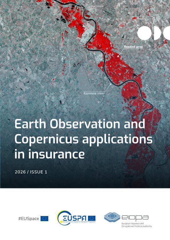
| 520 | $aThe document outlines how Earth Observation data and the services provided by the Copernicus programme can improve the assessment and monitoring of catastrophic risks in the European insurance sector. It presents evidence on the usefulness of satellite imagery for damage assessment, particularly in the case of floods, fires and extreme weather events. It describes the technical capabilities of Sentinel-1 and Sentinel-2, as well as the benefits of integrating spatial information into risk models and supervisory processes. It includes the results of a joint EUSPA-EIOPA pilot project to estimate flood damage using open data. It concludes by highlighting their potential to support more transparent, comparable and rapid decision-making in insurance and supervision | ||
| 650 | 4 | $0MAPA20080629755$aSeguro de riesgos extraordinarios | |
| 650 | 4 | $0MAPA20080604394$aValoración de riesgos | |
| 650 | 4 | $0MAPA20080608392$aRiesgos meteorológicos | |
| 650 | 4 | $0MAPA20260005737$aPrograma Copernicus | |
| 650 | 4 | $0MAPA20080552565$aSatélites | |
| 650 | 4 | $0MAPA20260001562$aRiesgos catastróficos | |
| 710 | 2 | $0MAPA20260005638$aEuropean Union Agency for the Space Programme | |
| 710 | 2 | $0MAPA20110000219$aEIOPA | |
| 856 | $uhttps://www.eiopa.europa.eu/document/download/35147f9b-552a-4b5a-acf0-292c1affb8b2_en?filename=EUSPA-EIOPA%20White%20Paper%20-%20Earth%20Observation%20and%20Copernicus%20applications%20in%20insurance.pdf |