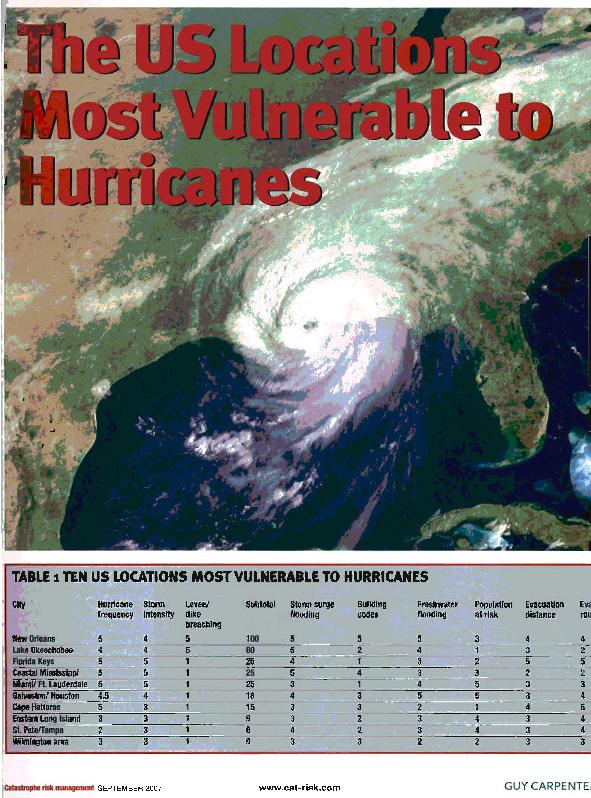
The United States locations most vulnerable to hurricanes

Contenido multimedia no disponible por derechos de autor o por acceso restringido. Contacte con la institución para más información.
| Tag | 1 | 2 | Valor |
|---|---|---|---|
| LDR | 00000cab a2200000 i 4500 | ||
| 001 | MAP20071508930 | ||
| 003 | MAP | ||
| 005 | 20200624140932.0 | ||
| 007 | hzruuu---uuuu | ||
| 008 | 071017e20070901usa|||| | |00010|eng d | ||
| 040 | $aMAP$bspa$dMAP | ||
| 084 | $a842 | ||
| 110 | 2 | $0MAPA20080443108$aLeatherman, Stephen | |
| 245 | 1 | 4 | $aThe United States locations most vulnerable to hurricanes$cStephen Leatherman |
| 520 | 8 | $aThe entire East and Gulf Coasts of the United States are subject to hurricane damage, but some places are especially vulnerable. This document shows the most frecuently areas affected by those disasters | |
| 650 | 1 | $0MAPA20080600204$aCatástrofes naturales | |
| 650 | 0 | 1 | $0MAPA20080551254$aHuracanes |
| 650 | 1 | 1 | $0MAPA20080563332$aMeteorología |
| 650 | 4 | $0MAPA20080608392$aRiesgos meteorológicos | |
| 650 | 1 | 1 | $0MAPA20080568863$aEstados Unidos |
| 740 | 0 | $aCastastrophe Risk Management | |
| 773 | 0 | $wMAP20077002080$tCatastrophe Risk management$dLondon$gSeptember 2007 ; p. 8-10 |

